Quantum GIS Tethys v.1.5-r13926-1
Advertisement
Description
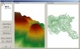
The Quantum GIS Tethys repository contains a lot of software from OSGeo projects. Quantum GIS Tethys and all dependencies are included, along with Python, GRASS, GDAL, etc. This is most suitable for people who want to be able to update dependencies from the Quantum GIS Tethys repository easily. The installer is able to install from internet or just download all needed packages beforehand. In both cases the downloaded files are kept in a local...
Read more
- Rate:
- Release Date:06/22/2011
- License:Freeware
- Category:Multimedia & Graphic Design
- Developer:QGIS Development Team
- Downloads:58
- Size:369 Kb
- Price: Free
To free download a trial version of Quantum GIS Tethys, click here
To visit developer homepage of Quantum GIS Tethys, click here
Advertisement
System Requirements
Quantum GIS Tethys requires Windows.
Quantum GIS Tethys v.1.5-r13926-1 Copyright
Shareware Junction periodically updates pricing and software information of Quantum GIS Tethys v.1.5-r13926-1 full version from the publisher using pad file and submit from users. Software piracy is theft, Using crack, password, serial numbers, registration codes, key generators, cd key, hacks is illegal and prevent future development of Quantum GIS Tethys v.1.5-r13926-1 Edition. Download links are directly from our publisher sites. Links Quantum GIS Tethys v.1.5-r13926-1 from Bittorrent, mediafire.com, uploadfiles.com, hotfiles.com rapidshare.com, megaupload.com, netload.in, storage.to, depositfiles.com and other files hosting are not allowed. The download file is obtained directly from the publisher, not from any Peer to Peer file sharing applications such as Shareaza, Limewire, Kazaa, Imesh, eDonkey, eMule, Ares, BearShare, Overnet, Morpheus, BitTorrent Azureus and WinMX.
Review This Software
More Quantum GIS Tethys Software
Advertisement
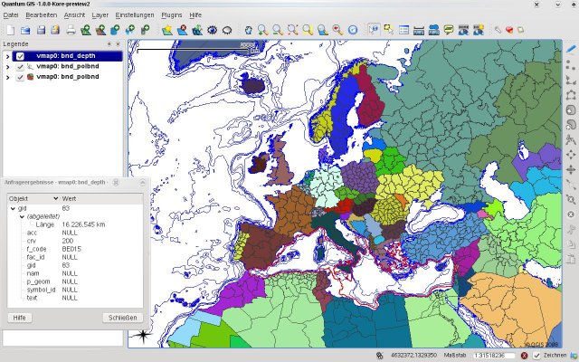
Quantum GIS v.1.8.0
Cross-platform and user friendly Open Source Geographic Information System (GIS). Quantum GIS (QGIS) is a user friendly Open Source Geographic Information System (GIS) that runs on Linux, Unix, Mac OSX, and Windows. QGIS supports vector, raster,
Quantum GIS form Mac v.1.8.0
QGIS supports vector, raster, and database formats and lets you browse and create map data on your computer.
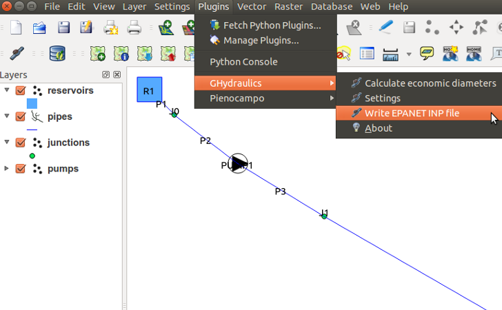
GHydraulics v.2.0.7
GHydraulics is a Quantum GIS plugin that allows to export water supply networks for analysis in EPANET.

Icons-Land Vista Style GIS/GPS/MAP Icon Set v.2.0
Vista Style GIS/GPS/Map Icon Set is of perfect design quality. Being represented in 7 sizes, icons can be widely used in local service applications, GPS tracking and GIS applications, and any kind of mapping applications.
My World GIS v.4. 1. 2011
My World GIS™ is a Geographic Information System (GIS) designed specifically for use in middle school through college classrooms.
GIS ObjectLand v.2. 6. 2003
GIS ObjectLand is a universal Geographic Information System for Windows. Key features: - creation of vector-raster maps with arbitrary structure of layers and feature types; - creation of themes. Theme is a user presentation of a map; - control of
Canvas GIS Advanced (Mac) v.9.0.4
About Canvas GIS Advanced (Mac)Adds native support for Geographic Information System (GIS) data to Canvas.
Quantum v.2.5.0
Quantum is a resilient p2p file sharing client able to deliver torrent download at great speeds and with a plus of convenience and accuracy. It includes features like multiple torrent downloads, queuing/priority systems and advanced seeding rules.
Tethys Macro SDK
Add Macro Recorder to your software or create custom macro applications with Tethys Macro SDK. Leverage the power of SMART Macro Technology. Integrate it with your software in just minutes. Use API or pre-defined GUI components. Simply cut and paste from
AvisMap GIS Engine
AvisMap GIS Engine is a comprehensive SDK for the development of custom GIS applications and solutions. This SDK provides several ActiveX (OCX) controls which support Visual Basic, VB.NET, C#, Visual C++ and other ActiveX compatible programming languages,
Total GIS Converter v.1.5
Total GIS Converter is a powerful converter of GIS files. It converts AEP, GRD, ADF, E00, FLT, APR, SHP, DXF and many other GIS formats to TIFF, PNG, JPEG, BMP. Along with conversion it can scale and resize your files. Download your free copy now!